The north side of College just west of Bathurst in 1925.
 2010 and the Church is gone but the house and stores remain.
 The north side of College just west of Bathurst in 1925.2010 and the Church is gone but the house and stores remain.
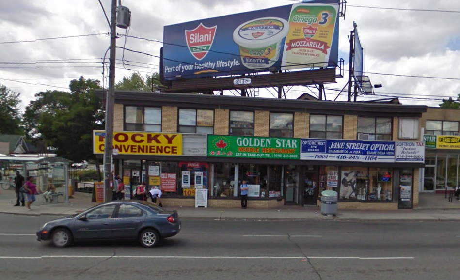
 Another strip plaza on the west side of Jane north of Lawrence, early 1960's.
 2010.
2010. The Turofsky brothers outside their original studio (1944-1954) at 92 King West.
 The N/W corner of Bay and Adelaide in the early 1800's, the home and brewery of John Doel.
 John Doel.
 The N/W corner of Bay and Adelaide in 1827 the home and brewery of John Doel.
 Although this photo is labelled 1914 in the archives it has to be earlier as E.S. Willard performed his final North American tour in 1905 and died in 1915. By now the rural family home of Mr. Doel has been converted to commercial space, an employment agency of some sort.
 E.S. Willard
 The N/W corner of Bay and Adelaide in 1910.
 Again in 1924 shortly before it's demolition.
 A wider shot in 1924 showing the empty lot......
 The same corner in 2010.
 1910.
1910. 2010.
2010. The intersection of Toronto and Adelaide Street in 1912. There were several public lavatories throughout the city then and are probably still there, buried under the pavement.
 The interior. It's a shame that the city is unable to provide "Public Necessaries" in these modern times. Everyone's got to go on occasion. They have them in New York City.
 Looking east along Adelaide (then Duke Street) at Sherbourne in 1933.
 2010. The building to the right, the Paul Bishop House, built in 1848 on the foundations of a previous house, has recently undergone a successful restoration.

 Looking North up Sherbourne across Adelaide.
 2010.
2010. Looking south in 1933 with the Hawes Foor Wax Company on the left.
 2010.
2010. Hawes Wax tin.
 Some correspondence.
 Looking north up Frederick Street from King in 1925 with the Campbell House in it's original location before the move in 1972. Adelaide was originally called Duke Street and Richmond was known as Duchess Street. A good history of the area can be found here.
 2010.
2010. The west side of Kingston Rd. just north of Dundas in the winter of 1950. Note the horse-drawn wagon on the left.
 2010 and Woods Drugstore is still in business, but the old sign was much better.
 The Ashbridges's Bay Fire Station on Commissioner Street during construction in 1923.
 1929.
1929. 2010 and no longer a Fire Station.
 An early view of College Street looking east from Bathurst with the College fire tower in the distance, The purpose of the tower is twofold. To have a high vantage point to see potential trouble and also to dry the original leather and later, linen fire hoses after use.
 2010 and the Fire Station is still here, or is it?
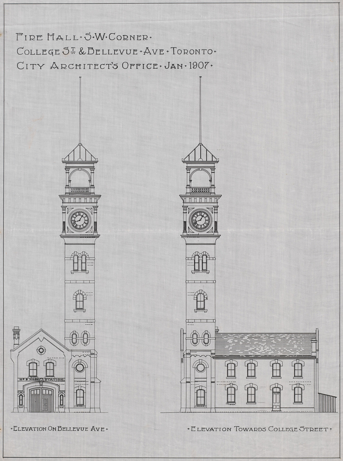 Station No. 8 plans.
 Another early hand tinted postcard from the Chuckman Collection.
 The N/W corner of Wilton (now Dundas) and Victoria in 1919. Note the O'Keefe Brewery building in the background. More on that below.
 A similar angle in 2010.
 That's the old O'Keefe Brewery behind the Edison Hotel.
 A map of the neighbourhood.
 An interesting selection of Streamline Delivery vehicles from the late 1930's and 40's.
 The Texaco Doodlebug!