The station sign off video about Toronto from the 80's from the original City TV channel 79.
Toronto, People City. It's a great song by Tommy Ambrose.

Tommy Ambrose.
One of Canada's most versatile popular singers and songwriters, Tommy Ambrose starred in his own half-hour show of music, variety, dance, and comedy. Produced by Stan Harris (196l-62) and Bill Davis (1962-63), and written by Stan Jacobson and Bernie Rothman, in addition to Ambrose and his guests the program featured an eight voice chorus, under the direction of Gordon Kushner, and a twenty-five piece orchestra conducted by Lucio Agostini, with arrangements by Rick Wilkins. Choreography for the show was by Glen Gibson.
During the summer of 1962, the network presented a dozen repeats from the previous season, under the title, The Best Of Tommy Ambrose.
Here's his sign off for Global TV.
A clip from his CBC show from 1962.
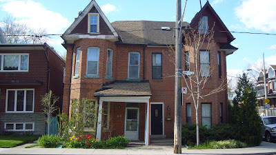
 These semis on Annette near Keele have a serious lean. The one on the right was re-faced and "straightened" several years ago but the left hand side shows just how severe the angle is.


