 The south side of Queen opposite Triller Avenue in Parkdale in the late 1890's.
 This could be the spot...
 The south side of Queen opposite Triller Avenue in Parkdale in the late 1890's.This could be the spot...
 A very old photo (circa 1870) of front Street looking towards the St. Lawrence Market, which at this time was Toronto's first City Hall. Note the "Gangs of New York" style top hat.
 A similar view in 2011.
 Toronto's original City Hall (1845-1899) before it was re-purposed as the St. Lawrence Market.
 The coloured centre indicates the remains of the original hall.
 The south side of front from Wellington looking towards the St. Lawrence Market in 1915.
 The same in 2011.
 A composite of the two.
 Looking south down Lower Church from Front Street in 1915. Note the proximity of the lake and ships to the Esplanade.
 The same view in 2010.
 A composite of the two photos.
 These men are excavating a dead body from the frozen lake in the winter of 1927. Sunnyside Pavilion can be seen in the distance.
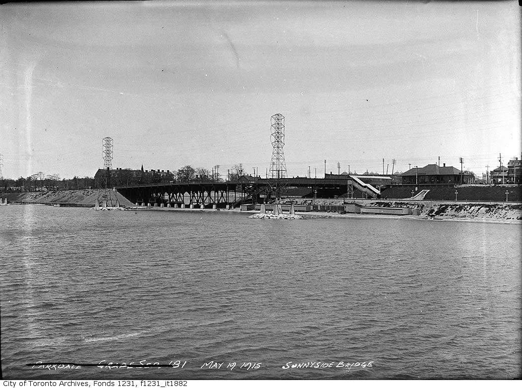 Just to give you an idea of how much land has been reclaimed through in fill along the Lakeshore at the foot of Roncesvalles in Parkdale, here is a photo of the lakefront in 1915.
 24 Leopold Street in Parkdale.
 The N/E corner of Camden and Brant as seen in 1937.
 The same spot in 2010.
 This block of condemned houses on the west side of Spadina north of Camden Street would soon be coming down to make way for..
 The Fashion Building. Built between 1925-1927by the Goldberg Brothers and Hartman.
 Another great book and resource is Spadina Avenue by Rosemary Donegan published in 1985.
 A surviving row of cottages on the east side of Spadina. When I was in art school a friend of mine lived in the yellow building upstairs.
 The N/W corner of King East and Power Street taken in 1937. A nice little corner store.
 Today.
 This book includes several walking tours around the downtown core.
 The west side of Church Street just south of McGill in 1937.
 2010, the building to the left remains.
 The east side of Sorauren Avenue, Parkdale in 1950. The interesting thing about this photo is the two Ontario Cottages to the left that are no longer there.
 2010.
2010.
 The Broadview Hotel.
 Looking West.
 Again.
 Looking East. These buildings would all soon be demolished to accommodate the new intersection/bridge over the Don in 1915.
 Before 1915.
 After.
 Looking east. That's the Old Don Train Station in the BG that's since been relocated to Todmorten Mills. The Don Station, the last surviving station of the Belt Line built in 1899, was moved from its original location on the Don River just south of Queen Street starting on August 2, 1969. Two days later, the three pieces of the station were reassembled at its new location in Todmorden Mills.
 The Station today.
 A wider shot looking east along King.
 From across the Don River looking west.
 The S/E corner of Yonge and Dundas (Dundas Square) in the early 1970's.
 Today.
 Another angle looking south at Burtons, the Store for Men.
 Looking north up Toronto Street from Court Street towards the Post Office Building on Adelaide in 1915.
 2010.
2010. Again but a little further back.
 2010.
2010.


